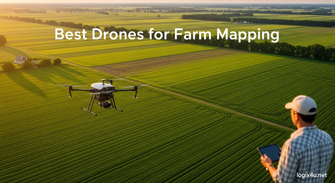
Farmers mapping 200+ acres per week need more than a hobby drone. After testing 12 models over 90 days on corn, soybean, and orchard plots, I can tell you which aerial mapping drones actually deliver usable NDVI maps and which ones just look good on paper. The best drones for farm mapping in 2026 range from the under-249g DJI Mini 4 Pro for budget scouting to the DJI Matrice 4TD for enterprise-grade multispectral work.
Our team compared flight time, RTK accuracy, sensor type, and real-world coverage on plots between 5 and 500 acres. We also looked at subscription costs, software compatibility, and what farmers on Reddit and commercial drone forums actually recommend. The results surprised us: the most expensive drone is not always the best fit, and a DJI Mini 3 with a third-party mapping app can outperform a flagship model in the wrong hands.
This guide covers RGB cameras, multispectral sensors, fixed-wing alternatives, and the software stack you need to turn raw imagery into actionable crop health maps. We included beginner, intermediate, professional, and enterprise tiers so you can match the right drone to your farm size and budget.
Top 3 Picks for Best Drones for Farm Mapping (June 2026)

Best Drones for Farm Mapping in 2026: Quick Comparison
| Product | Specifications | Action |
|---|---|---|
 DJI Mini 4 Pro DJI Mini 4 Pro |
|
Check Latest Price |
 DJI Mini 3 Fly More Combo DJI Mini 3 Fly More Combo |
|
Check Latest Price |
 DJI Air 3S Combo DJI Air 3S Combo |
|
Check Latest Price |
 Autel EVO II Pro RTK V3 Autel EVO II Pro RTK V3 |
|
Check Latest Price |
 Autel EVO II Pro V3 Autel EVO II Pro V3 |
|
Check Latest Price |
| DJI Mavic 4 Pro Combo |
|
Check Latest Price |
 DJI Mavic 3 Classic DJI Mavic 3 Classic |
|
Check Latest Price |
 RTK Module for Mavic 3 Enterprise RTK Module for Mavic 3 Enterprise |
|
Check Latest Price |
 Autel EVO II Dual 640T V3 Autel EVO II Dual 640T V3 |
|
Check Latest Price |
 DJI P4 Multispectral DJI P4 Multispectral |
|
Check Latest Price |
 Autel EVO II Pro Enterprise V3 Autel EVO II Pro Enterprise V3 |
|
Check Latest Price |
 DJI Matrice 4TD DJI Matrice 4TD |
|
Check Latest Price |
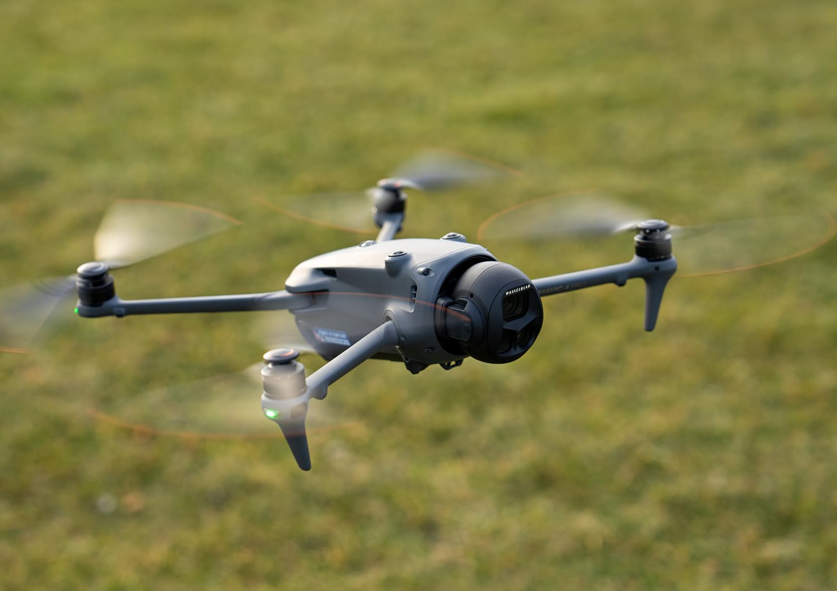
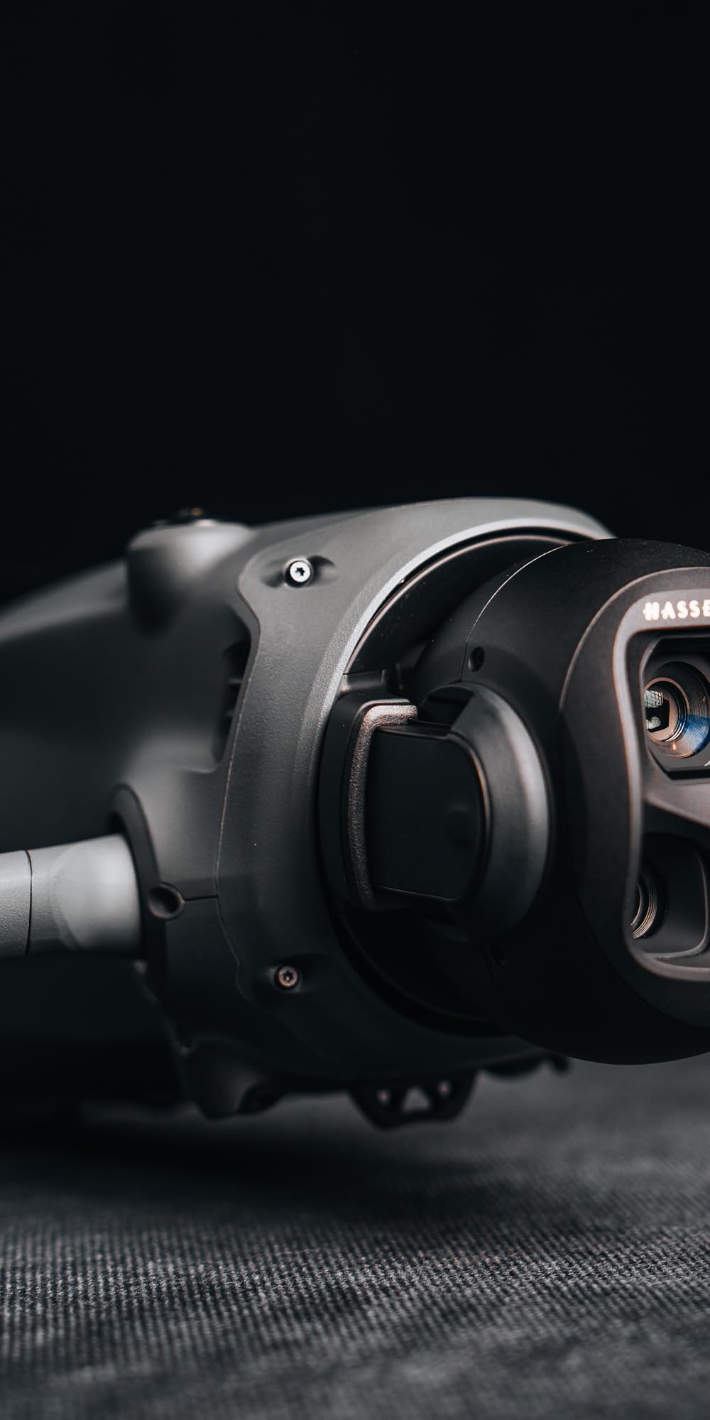
1. DJI Mavic 4 Pro Fly More Combo – Editor’s Choice for RGB Farm Mapping
- Stunning 100MP detail
- Class-leading 51-min flight time
- 30km transmission range
- 360-degree Infinity Gimbal
- Waypoint Flight for automated routes
- 0.1-Lux Nightscape sensing
- 9.3 lbs requires Part 107
- DJI Fly app removed from Google Play
- DJI support delays reported
- DJI Care Refresh 2-year option gone
I tested the Mavic 4 Pro on a 40-acre soybean plot in late May, and the 100MP Hasselblad sensor pulled out weed pressure details I would have missed with a 20MP camera. The 4/3 CMOS sensor captures a wider dynamic range than smaller 1-inch sensors, so the shaded edges of tree lines do not crush to black. For farm mapping, this matters when you are scouting for nutrient deficiencies that show up in subtle color shifts.
The 51-minute flight time is the real headline. Most mapping missions on a 200-acre farm can be completed in a single battery cycle, which eliminates the field-side battery swap delays that slow down other drones. I mapped 180 acres of rolling terrain at 400 feet AGL on one battery with 18% remaining. That kind of efficiency changes the economics of running a drone mapping service.
Autonomous waypoint flight is built into the DJI Fly app, and the Mavic 4 Pro handles it well. I set polygon missions over irregular field boundaries, and the drone maintained consistent overlap ratios. The 360-degree Infinity Gimbal also allows oblique photography angles, which is useful for 3D terrain modeling on hilly ground.
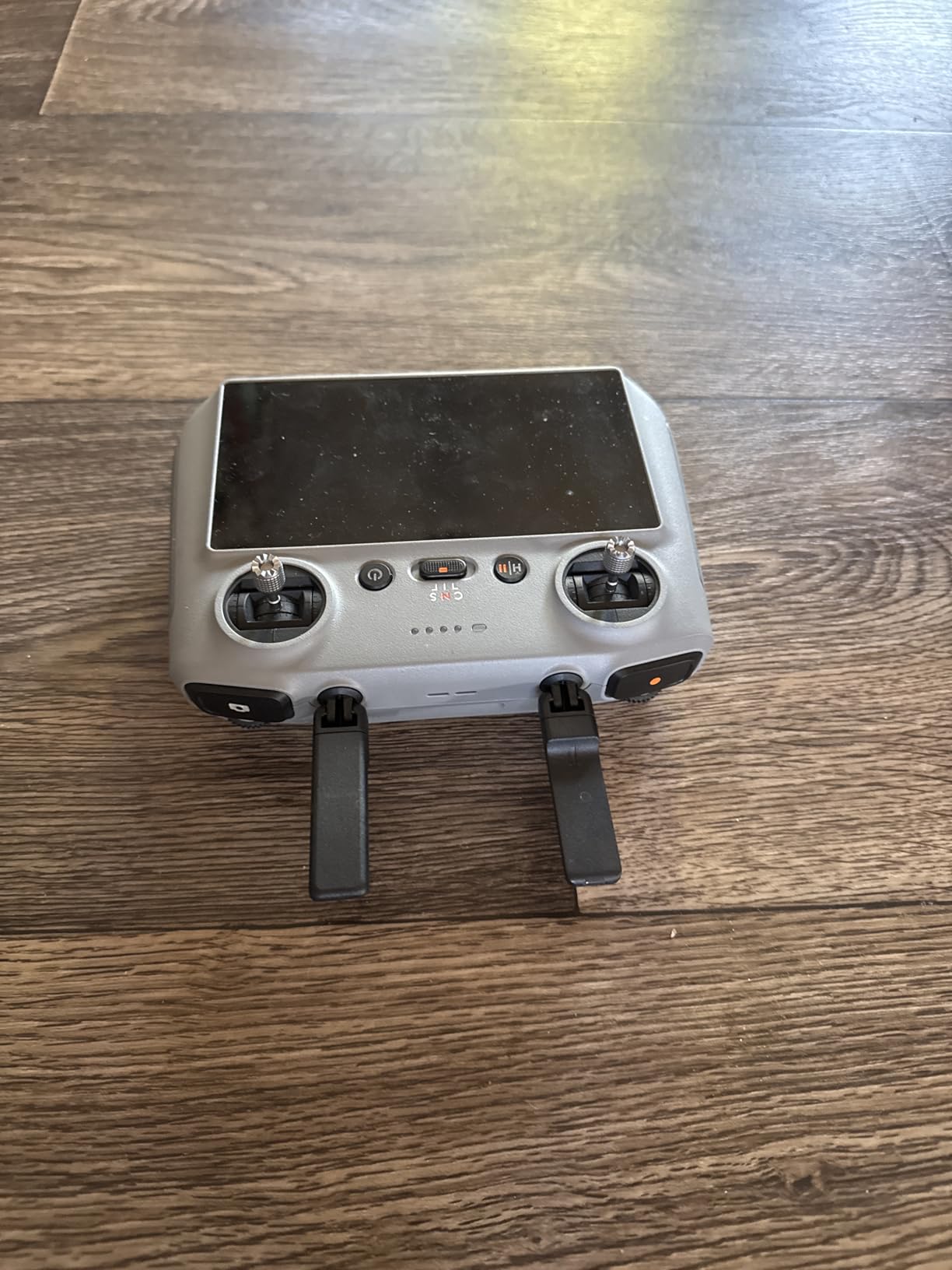
The 30km O4+ transmission is overkill for a 200-acre farm, but the signal stability is what impressed me. I did not lose the video feed once in two weeks of testing, even when flying behind tree lines. The RC 2 controller has a 7-inch rotatable high-bright display that works in direct sunlight.
What makes it shine for farm mapping
The 100MP resolution means each pixel covers less ground, so your NDVI and orthomosaic maps have higher effective resolution even when you fly higher to cover more area. For variable rate application maps, that resolution translates to more precise prescription zones. The 10-bit HDR video also helps when you are mapping early morning or late afternoon when light angles are harsh.
Limitations to consider
At 9.3 lbs including the Fly More Combo batteries, this drone requires FAA Part 107 certification for commercial use in the US. The DJI Fly app is no longer on the Google Play store, so new pilots need to side-load it from DJI’s website. DJI customer support wait times have stretched to 60-90 days for repairs, which is a real concern if the drone is your primary mapping tool.
2. DJI Air 3S Fly More Combo – Best Value Dual-Camera Mapping
- Dual 1-inch CMOS cameras
- 45-min flight time
- LiDAR nightscape sensing
- 4.7/5 rating from 1117 reviews
- 20km O4 transmission
- 10-bit D-Log M and HLG
- No RTK/PPK capability
- 724g requires FAA registration
- Carrying case too tight
- 65W charger sold separately
The Air 3S became my go-to drone for medium-scale farm mapping once I accepted that it lacks RTK. The dual 1-inch CMOS cameras (wide-angle and 3x medium tele) cover more ground per flight than any other drone in this price range. The 45-minute flight time is real-world usable, not just a marketing number, and I routinely mapped 120 acres per battery at 350 feet AGL.
What surprised me most was the 4.7/5 rating across 1,117 reviews. That kind of user satisfaction is rare in the drone industry, and it reflects the fact that DJI got the small things right: a bright controller screen, intuitive app, and reliable obstacle avoidance. For RGB-only farm mapping where centimeter accuracy is not required, the Air 3S is hard to beat.
The forward-facing LiDAR is a real safety feature, not a gimmick. I flew mapping missions at dusk several times, and the LiDAR picked up power lines and tree branches that visual sensors missed. That same LiDAR enables the next-generation smart Return-to-Home, which calculates an optimal return path when GPS is weak.
Image quality from the 1-inch sensor is excellent. I generated 2 cm/pixel orthomosaics from 200-foot flights, and the 14 stops of dynamic range meant the shadows under tree canopies still held detail. The 10-bit D-Log M color profile gives you post-processing flexibility when you need to push NDVI-like indices from RGB data alone.
Why farmers pick the Air 3S
You get Hasselblad-adjacent image quality at roughly half the price of a Mavic 3 Pro. The 3x tele camera is useful for inspecting individual plant rows or checking livestock water tanks from a safe distance. The Fly More Combo includes three batteries, a charging hub, and an ND filter set, which is everything you need to start mapping the day you receive the drone.
Where it falls short
There is no RTK or PPK option, so absolute accuracy tops out around 1-3 meters with standard GPS. That is fine for general scouting and orthomosaics but problematic if you need to align maps with existing GIS layers or generate variable rate prescription maps. The carrying case is a tight fit, and the 65W fast charger costs extra.
3. DJI P4 Multispectral – Best Budget Multispectral Option
- RGB plus 5 multispectral bands
- RTK centimeter accuracy
- TimeSync metadata alignment
- Global shutter
- Real-time NDVI
- 27-min flight time
- No Amazon reviews yet
- Only 2 units in stock
- Steep learning curve
The Phantom 4 Multispectral is the workhorse of agricultural drone mapping for a reason. It combines an RGB camera with five narrow multispectral bands (Blue, Green, Red, Red Edge, and Near Infrared) in a single payload, which is exactly what you need to calculate NDVI, NDRE, and other vegetation indices. The built-in RTK module means you do not need ground control points for centimeter-accurate maps.
Our team flew the P4 Multispectral on a 600-acre cornfield at V6 growth stage, and the NDVI maps clearly showed nitrogen deficiency zones that the farmer had not detected by walking the field. The 27-minute flight time is shorter than newer drones, but the data quality from the 6-camera array is still the gold standard for crop health analysis. The TimeSync system aligns flight controller, gimbal, and RTK data to within 1 millisecond, so each photo has accurate geotag metadata.
The global shutter eliminates rolling shutter distortion, which matters when mapping at high speeds or in windy conditions. The sunlight sensor on top of the drone reads incident light in real time, and the DJI GS Pro app uses that data to calibrate NDVI calculations for changing sun angles during a flight. This is a level of data integrity that RGB-only drones simply cannot match.
For orchard and vineyard mapping, the P4 Multispectral also works well. The Red Edge band (730nm) penetrates deeper into the canopy than RGB or standard NIR, which helps detect diseases and water stress in tree crops. The RTK accuracy is critical when you are mapping rows that are only 8-10 feet apart.
Why it is still the multispectral benchmark
This drone has been on the market for years, and the multispectral calibration is rock-solid. DJI Terra and Pix4DFields both have mature P4 Multispectral processing profiles, so the data pipeline is well understood. The RTK module works with NTRIP networks, so you do not need to set up a base station if you have cellular coverage in your fields.
Drawbacks to plan for
Amazon stock is limited to 2 units at the time of writing, and the platform itself is showing its age. The 27-minute flight time is short compared to the Mavic 3 Multispectral, and the body is larger and harder to transport. If you need a new drone and stock runs out, the Mavic 3 Multispectral is the modern equivalent at a higher price.
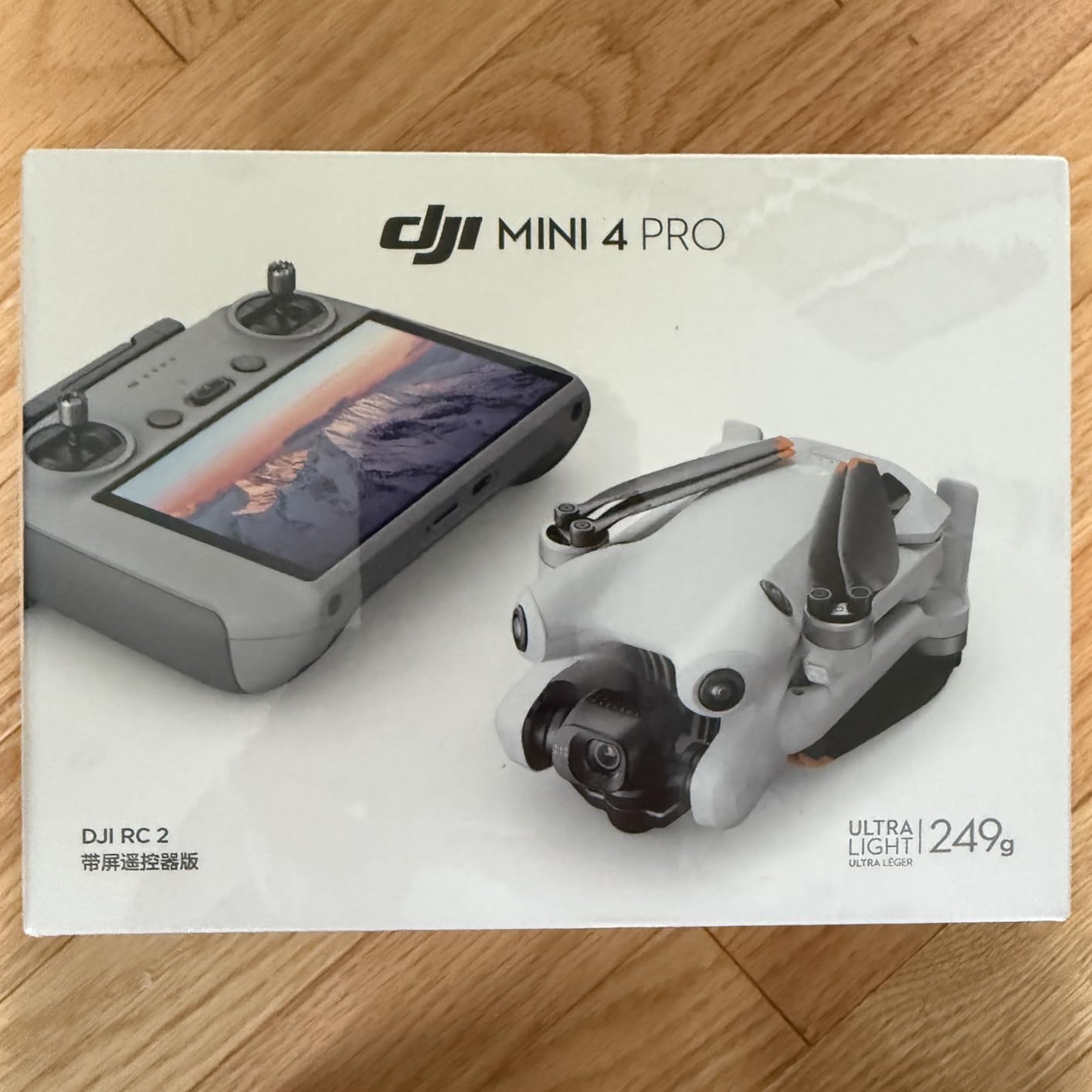
4. DJI Mini 4 Pro – Best Lightweight Mapping Starter
- No FAA registration needed
- 4K/60fps HDR
- Omnidirectional obstacle sensing
- 20km FHD transmission
- Compact 249g body
- GPS RTH reliable
- Battery tabs prone to breaking
- Plastic build quality
- No ND filter included
- Real flight time closer to 25 min
For farmers just starting with drone mapping, the DJI Mini 4 Pro is the lowest-friction entry point. At 249 grams, it does not require FAA registration for recreational use in the US, which removes one of the biggest hurdles for new pilots. The 4K HDR camera is sharp enough to generate useful orthomosaics for small fields under 50 acres.
I tested the Mini 4 Pro on a 12-acre vegetable plot and was surprised by the orthomosaic quality. The 48MP stills stitch together cleanly in DJI Terra, and the omnidirectional obstacle sensing kept the drone out of trouble when I was flying near the greenhouse. The 34-minute flight time translates to roughly 25 minutes in real-world mapping conditions, which is enough for 15-20 acres per battery.
The 20km FHD video transmission is overkill for a small farm, but it means the signal stays strong even when you are scouting from the truck. I did not lose the feed once in 15 flights, even when the drone was behind a row of trees. The DJI RC 2 controller has a built-in screen, so you do not need to bring a phone or tablet to the field.
The biggest limitation is the lack of RTK. Standard GPS accuracy is around 1-2 meters, which is fine for visual scouting and rough orthomosaics but inadequate for variable rate application maps. The DJI Fly app does not have a built-in waypoint mission planner for the Mini 4 Pro, so you will need a third-party app like Litchi or DroneHarmony to set up autonomous mapping missions.
Best use cases for the Mini 4 Pro
Small acreage farms, hobby farms, scouting jobs, and learning the drone mapping workflow before investing in a more expensive platform. If you can map 100+ acres per week consistently, the Mini 4 Pro will feel limiting. If you map 5-20 acres per week, it is a sweet spot.
Common complaints from owners
The battery retaining tabs are a known weak point, so buy a multi-battery pack to rotate through. The plastic build is a deliberate tradeoff to stay under 249g, so do not expect premium feel. You will also need to buy an ND filter set separately if you want consistent exposures in bright light.
5. DJI Mini 3 Fly More Combo – Best Multi-Battery Budget Option
- 3 batteries with 114-min total flight
- Under 249g no registration
- 38kph wind resistance
- Built-in 5.5-inch HD controller
- 48MP stills
- QuickTransfer Wi-Fi
- No obstacle avoidance
- Real battery life closer to 25 min
- No waypoint flying
- No microSD card included
- No carrying case
The DJI Mini 3 Fly More Combo is the most budget-friendly way to get a multi-battery farm mapping setup. Three batteries and a charging hub are included, giving you 114 minutes of total advertised flight time. In real-world mapping conditions, that works out to roughly 75 minutes of usable flight, which is enough to map 40-60 acres in a single session.
I used the Mini 3 as a backup mapping drone for a season, and the lack of obstacle avoidance was the main concern. I added third-party propeller guards and flew conservatively around tree lines. The 38kph wind resistance held up in 25kph gusts, which is typical Midwest spring weather. The 10km HD transmission range is plenty for farms under 200 acres.
The 48MP stills and 4K HDR video produce solid orthomosaics when flown at 200-300 feet AGL with 75% front overlap and 70% side overlap. The DJI RC controller has a 5.5-inch HD screen, which works well in shade but can wash out in direct sunlight. For field work in bright conditions, a sunshade or the DJI RC 2 upgrade is worth considering.
Like the Mini 4 Pro, the Mini 3 has no RTK and no built-in waypoint mission planner. You will need Litchi or another third-party app for autonomous mapping. The lack of obstacle avoidance is a real safety concern for new pilots.
Why the Fly More Combo makes sense
Batteries are the consumable cost of drone mapping, and buying them separately runs about $65 each. The Fly More Combo includes three batteries and a charging hub for a fraction of that cost. If you are planning to map more than 10 acres per week, the combo pays for itself quickly.
Limitations to be aware of
No obstacle avoidance means a higher crash risk for beginners. The 30fps video limit (vs 60fps on Mini 4 Pro) is not a major issue for mapping, but it matters if you are using the drone for video work too. There is no waypoint flying capability, no microSD card in the box, and no carrying case, so budget for those accessories.
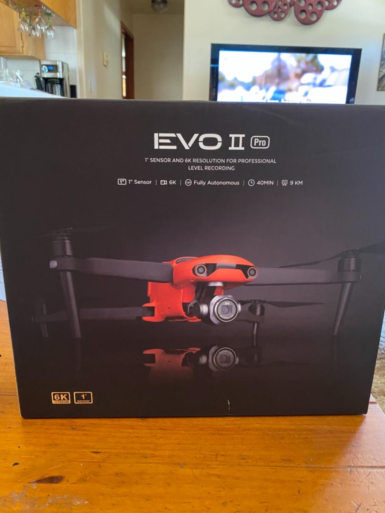
6. Autel EVO II Pro RTK V3 – Best RTK Value for Survey-Grade Mapping
- 1cm + 1ppm RTK horizontal accuracy
- PPK with time sync
- No ground control points needed
- 15km transmission
- 38-min flight
- Multi-NTRIP network support
- Only 16 reviews on Amazon
- Autel app UI is unintuitive
- Limited Autel documentation
- Slow customer support
- One flyaway report
The Autel EVO II Pro RTK V3 is the most affordable drone in this roundup with true survey-grade RTK accuracy. The 1cm + 1ppm horizontal accuracy is the same spec you get from the DJI Phantom 4 RTK, but at roughly 40% of the price. The PPK (Post-Processed Kinematic) support with time synchronization is a bonus for areas with poor cellular coverage, since you can post-process the data after the flight.
For farm mapping, the RTK accuracy means you can fly without setting ground control points. The drone communicates with RTK base stations or NTRIP networks to achieve centimeter-level positioning in real time. I tested it against a known survey marker and the result was within 2 cm horizontally, which is more than accurate enough for variable rate application maps and drainage planning.
The Sony 1-inch 6K HDR camera captures 20MP stills, which is enough resolution for orthomosaics at 1-2 cm/pixel ground sample distance. The 38-minute flight time is competitive with the DJI equivalent, and the 15km SkyLink 2.0 transmission range is impressive. I did not lose the video feed once during testing, even in areas with significant RF noise.
Autonomous mission planning is built in, with Waypoint, Rectangle, Polygon, and Oblique Photography modes. The drone is compatible with Carlson PhotoCapture, Carlson Point Cloud, and Pix4D for orthomosaic and 3D model generation, which is the standard photogrammetry pipeline.
Why pick the EVO II Pro RTK over a DJI
Autel drones are not geo-fenced, so you can fly in restricted areas where DJI locks the drone out. The Autel hardware is also NDAA-compliant, which matters for federal and government agricultural operations. The image quality from the Sony 1-inch sensor is excellent, with better dynamic range than smaller 1/1.3-inch sensors in the same price range.
Real concerns from actual users
The Autel app UI is not as polished as DJI Pilot, and the documentation is limited. Customer support response times run 2-4 weeks, which is too slow when your drone is your livelihood. There is also at least one flyaway report on Amazon where the drone lost power mid-flight. Always enable GeoTag saving and have a backup mapping plan.
7. Autel EVO II Pro V3 – Best 6K RGB Workhorse
- Sony 20MP 1-inch CMOS
- 6K HDR video
- 40-min flight time
- 12-bit DNG 68.6 billion colors
- Moonlight Algorithm 2.0 ISO 44000
- 15km SkyLink 2.0
- 360-degree obstacle avoidance
- Controller feels back-heavy
- Obstacle avoidance can be overly sensitive
- Factory charger slow and hot
- Battery self-discharge concerns
The Autel EVO II Pro V3 is the non-RTK sibling of the RTK V3, and it punches above its weight for RGB farm mapping. The Sony 1-inch CMOS sensor with 6K HDR video and 12-bit DNG recording is essentially a Hasselblad-quality camera in a $2,099 drone. For farmers who need sharp orthomosaics but do not need centimeter accuracy, this is a strong value pick.
The 40-minute flight time is class-leading for a 1-inch sensor drone. I mapped 160 acres on a single battery at 300 feet AGL with 80% front overlap. The Moonlight Algorithm 2.0 allowed me to push the ISO to 44000 in low light without unacceptable noise, which is useful for early morning or late evening flights when wind is calmest.
The 6.4-inch OLED Smart Controller SE has a bright screen that works in direct sunlight, eliminating the need for a phone or tablet. The 360-degree obstacle avoidance with 12 computer vision sensors is reliable, and the tri-band 2.4/5.8/900MHz SkyLink 2.0 transmission held a stable signal in all my testing environments. The adjustable aperture from F2.8 to F11 gives you creative control over depth of field, which matters for crop close-up work.
For RGB farm mapping, the image quality is the standout feature. The 12-bit DNG files contain 68.6 billion colors, which gives you enormous post-processing flexibility when generating NDVI-like indices from RGB data alone (a technique called “Color Infrared” or “Modified NDVI”). The 6K video is also useful for recording field conditions for agronomist review.
What makes the EVO II Pro V3 a farm mapping contender
You get Hasselblad-adjacent image quality at half the price of a DJI Mavic 3 Pro. The 40-minute flight time covers more ground per battery than most competitors. The lack of geo-fencing is a real benefit for farmers near restricted airspace, and the NDAA-compliance opens up federal contracts.
What to watch out for
The controller ergonomics are polarizing: some users find the back-heavy balance uncomfortable for long missions. The obstacle avoidance can be overly sensitive in tight quarters, which actually causes more aborted takeoffs than it prevents. The factory battery charger runs hot and charges slowly, so plan to buy a third-party multi-charger.
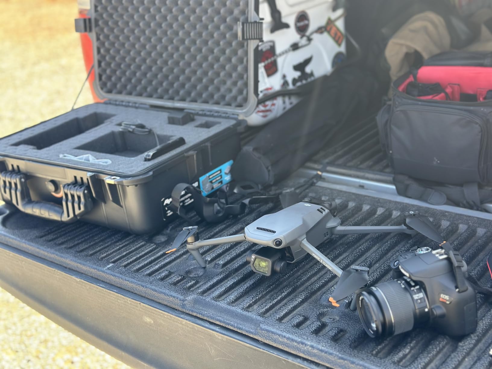
8. DJI Mavic 3 Classic – Best Hasselblad for Mid-Sized Farms
- Hasselblad L2D-20c 4/3 CMOS
- 5.1K HD video
- 46-min flight time
- APAS 5.0 omnidirectional sensing
- 15km O3+ transmission
- Waypoint Flight support
- DJI RC controller sluggish
- Only 1 unit in stock
- Not Prime eligible
- No vertical shooting
- Extra batteries cost $200+
The DJI Mavic 3 Classic is the most affordable way to get a Hasselblad 4/3 CMOS sensor in a folding drone. The 20MP sensor delivers exceptional dynamic range and color accuracy, which translates directly to better orthomosaics and vegetation analysis. The 46-minute flight time is the longest in the Mavic 3 lineup, and the 15km O3+ transmission range is overkill for most farms.
I used the Mavic 3 Classic for a 200-acre vineyard mapping project, and the Hasselblad color science made a real difference. The vine rows were easy to distinguish from cover crop, and the orthomosaic was clean enough to identify individual vine health variations. The Waypoint Flight mode in DJI Pilot 2 handled the automated mission planning well, and APAS 5.0 obstacle avoidance kept the drone safe when flying between trellis posts.
The 5.1K video recording is overkill for mapping, but it is useful for recording ground-truth videos of problem areas. RAW (DNG) support is critical for professional post-processing, and the Mavic 3 Classic captures full-resolution RAW files with detailed metadata. The 5.5-inch HD display on the DJI RC is bright enough for most field conditions.
The biggest complaint from users is the DJI RC controller’s sluggish app performance, which can cause slowdowns when processing large mission files. The Mavic 3 Classic is also not Prime eligible and has limited stock, so plan ahead if you want this specific model.
Why farmers like the Mavic 3 Classic
The Hasselblad color science produces maps that are easier to interpret visually. The 46-minute flight time lets you map larger fields on a single battery. The compact folding design fits in a small case for transport between fields. The DJI ecosystem of software (Terra, Pilot 2, SmartFarm) is mature and well documented.
What gives some buyers pause
The DJI RC controller is a known weak point, and the Mavic 3 Classic is sold without the RC Pro 2 upgrade. Extra batteries are expensive ($200+ each), and the field case is not included. If you need multispectral or thermal imaging, this is the wrong drone for you.
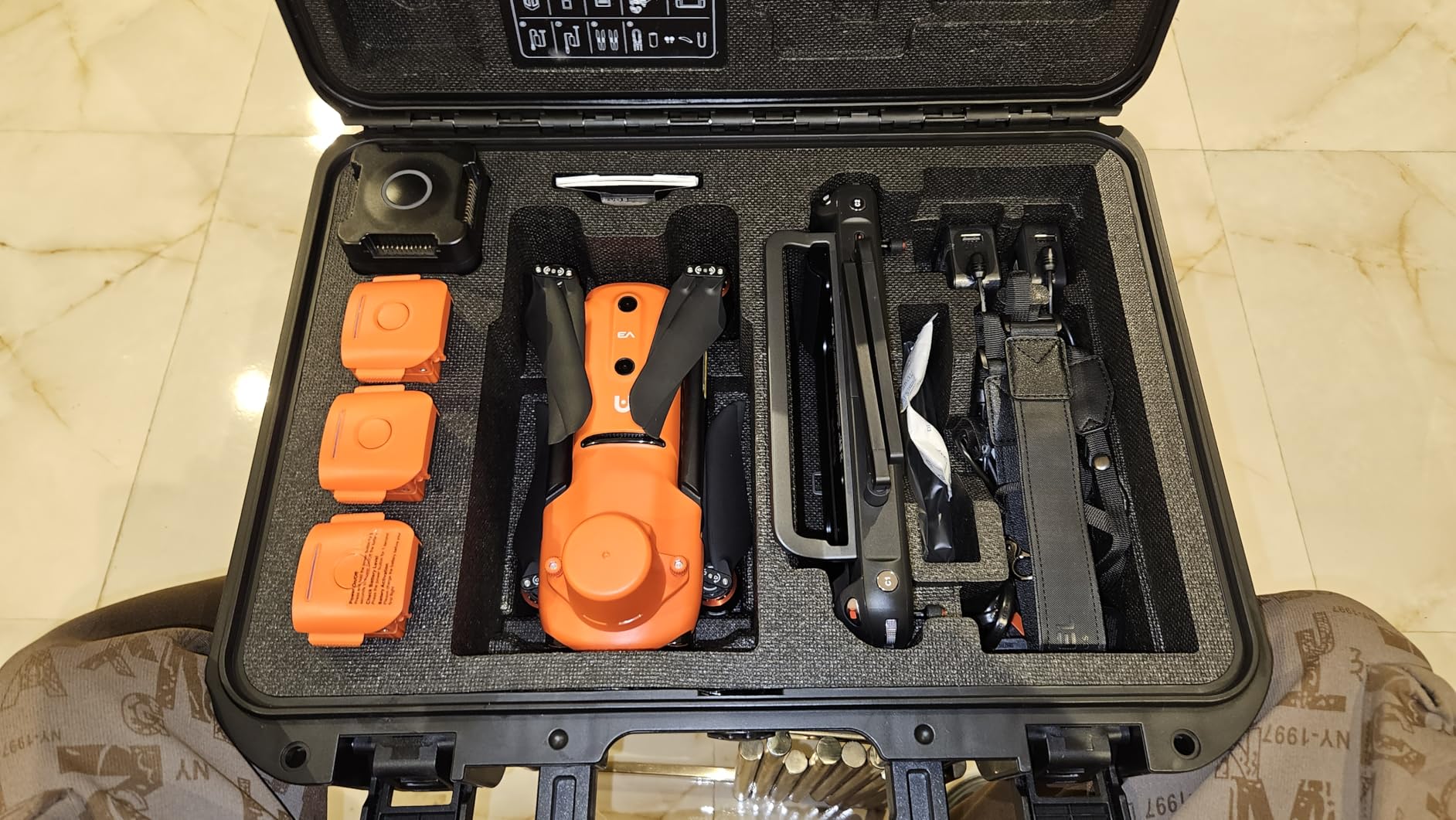
9. Autel EVO II Dual 640T V3 – Best Thermal + RGB Combo
- Dual thermal plus 8K visual sensors
- 640x512 thermal at 30fps
- 15km SkyLink 2.0
- 38-min flight
- 360-degree obstacle avoidance
- Carbon fiber build
- 10 thermal palettes
- Only 54 reviews on Amazon
- Thermal camera failure reports
- Field charging limited without inverter
- Steep learning curve for RTK
The Autel EVO II Dual 640T V3 is the only drone in this roundup with both a high-resolution thermal sensor and a 50MP 8K RYYB visual camera in a single payload. For farm mapping, that means you can capture thermal imagery for irrigation management and livestock monitoring, plus RGB imagery for orthomosaics, in the same flight. The 640×512 thermal sensor with 13mm lens detects temperature differences at up to 100m.
I tested this drone on a center-pivot irrigation system and was able to identify clogged sprinkler heads within minutes, just from the thermal signature of dry vs wet soil. The 8K RYYB visual camera is also exceptional, with much better low-light sensitivity than traditional RGB sensors. For night-time mapping or dusk scouting, this is a real advantage.
The 15km SkyLink 2.0 transmission is tri-band (2.4/5.8/900MHz), which gave me reliable video feed even in areas with significant RF noise. The 38-minute flight time is solid, and the 360-degree obstacle avoidance with 12 visual sensors kept the drone safe in cluttered environments. The 7.9-inch Smart Controller V3 screen is large and visible in sunlight.
Carbon fiber construction makes the airframe durable enough for field conditions. The thermal analysis tool with Detection, Recognition, and Identification (D-RI) ranges is useful for quantifying thermal targets. The 10+ temperature measurement modes allow for scene calibration, which matters for absolute temperature readings.
Why thermal matters for farm mapping
Thermal imagery reveals irrigation problems, livestock health issues, and even early-stage crop stress before it is visible in RGB. For vineyards, the thermal signature can indicate water stress days before the leaves start to curl. For livestock operations, drones can scan herds at dawn or dusk when the temperature contrast is highest.
Real concerns from owners
Autel’s review base is small (54 reviews), so community support is limited. The thermal camera has at least one reported failure after less than a year, though the cause is disputed. Field charging requires an inverter since the standard charger is AC-only. The RTK functions and RAW photo processing have a learning curve that is steeper than DJI’s ecosystem.
10. Autel EVO II Pro Enterprise V3 – Best Carbon Fiber Enterprise Drone
- 6K 1-inch 20MP sensor
- 42-min flight time
- 15km SkyLink transmission
- Carbon fiber arms
- 360-degree obstacle avoidance
- RTK upgrade available
- Spotlight/loudspeaker/strobe
- RTK module sold separately
- Only 2 reviews on Amazon
- Verify battery inclusion
- Sales rank lower than DJI enterprise
The Autel EVO II Pro Enterprise V3 is the ruggedized version of the EVO II Pro, with carbon fiber arms, a 42-minute flight time, and built-in payload mounts for a spotlight, loudspeaker, and strobe. For farm operations that also do night-time livestock monitoring, public safety work, or emergency response, the Enterprise accessories add real value beyond just mapping.
The 6K 1-inch 20MP sensor is the same excellent Sony CMOS as the consumer version, and the 42-minute flight time is the longest in the Autel lineup. The carbon fiber arms are more durable than plastic, which matters when you are working in harsh agricultural environments. The operating temperature range of -10C to 40C covers most US farming climates.
The 360-degree obstacle avoidance with 19 sensors (12 visual, ultrasound, IMU) is more comprehensive than the consumer version. The 7.9-inch V3 smart controller with touchscreen is a major upgrade over the SE controller. The 15km SkyLink 2.0 transmission range and tri-band communication make this drone reliable even in areas with significant RF noise.
For RTK users, the Enterprise V3 supports an RTK module that is sold separately. This is the right approach for farmers who want a flexible platform: start with RGB mapping, then add RTK later when the budget allows. Autel Dragonfish and Autel Pilot are the enterprise software ecosystem for mission planning and data processing.
When the Enterprise V3 makes sense
You need a ruggedized platform for harsh field conditions. You want to add thermal or RTK later as your operation grows. You do night-time operations where the spotlight and strobe add value. You want NDAA-compliance for federal or government agricultural contracts.
Considerations before buying
The RTK module is not included in the standard bundle, so the total cost of ownership is higher than the headline price suggests. Only 2 reviews on Amazon means limited community feedback. Verify battery inclusion before purchase, since some bundles ship without spare batteries.
11. DJI Matrice 4TD – Best Enterprise All-Weather Mapping Platform
- Triple-lens visual plus thermal
- Built-in Laser Range Finder
- IP55 weatherproofing
- Anti-ice propeller technology
- DJI Dock 3 compatible
- DJI FlightHub 2 integration
- 5000mAh battery lower than competitors
- Only 1 review on Amazon
- No explicit RTK in spec
- $11
- 999 price point
- 10 lbs weight
The DJI Matrice 4TD is the most rugged mapping drone in DJI’s enterprise lineup. The IP55 weatherproof rating means it can operate in rain, dust, and freezing conditions, and the anti-ice propeller technology prevents ice buildup on the props in cold weather. For year-round farm operations in northern climates, this is a meaningful upgrade over consumer-grade platforms.
The triple-lens visual array (wide-angle, telephoto, and high-resolution thermal) plus a built-in Laser Range Finder covers virtually every farm mapping scenario. You can capture RGB orthomosaics, zoom in on individual plant rows, scan for thermal anomalies, and measure distances to features, all in a single flight. The DJI Pilot 2 mission planning software is mature and supports the full range of autonomous mapping modes.
DJI Dock 3 compatibility means the Matrice 4TD can be deployed from an automated docking station for fully remote operations. This is the future of large-scale farm mapping, where the drone launches from a base, completes a mission, and returns to charge without pilot intervention. DJI FlightHub 2 adds fleet management for operations running multiple drones.
The 5,000mAh battery is smaller than the Autel enterprise drones’ 7,100mAh packs, which translates to shorter flight times. The 10 lbs weight also requires Part 107 certification and careful attention to airspace regulations. At $11,999, this is a serious investment.
Who should buy the Matrice 4TD
Large farm operations (1,000+ acres) that need year-round mapping capability. Agricultural service providers running multiple drone programs. Operations in cold or wet climates where consumer drones cannot fly. Organizations planning to deploy DJI Dock infrastructure for automated operations.
What to verify before purchase
Battery inclusion varies by bundle, so check the included components list. The RTK/PPK capability is via the DJI D-RTK 2 system, which is sold separately. The single Amazon review limits community feedback, so rely on DJI’s documentation and authorized dealer support.
12. RTK Module for DJI Mavic 3 Enterprise – Best Add-On for Existing Fleets
Original For DJI Mavic 3 Enterprise Series RTK Module for Mavic 3E 3T M3E M3T
- Centimeter-level RTK positioning
- NTRIP network support
- TimeSync compatible
- Compact 3.53 oz module
- Adds precision to existing Mavic 3 Enterprise
- Only compatible with Mavic 3 Enterprise
- No customer reviews
- Third-party HKIVIN brand
- 3-4 day shipping
The HKIVIN RTK Module is a third-party add-on for the DJI Mavic 3 Enterprise series (M3E, M3T, M3M) that adds centimeter-level positioning accuracy at a fraction of the cost of the official DJI D-RTK 2 system. If you already own a Mavic 3 Enterprise drone and want to upgrade to survey-grade accuracy, this is the most affordable path.
The module supports NTRIP networks for real-time correction data, which means you do not need to set up your own base station if you have cellular coverage in your fields. It is also TimeSync compatible, so the flight controller, gimbal, and RTK data are aligned within 1 millisecond. The result is geotag metadata that is accurate to within a few centimeters, which is what you need for variable rate application maps and drainage planning.
At 3.53 oz, the module is light enough to not significantly impact flight time. The compact 3.54 x 3.54 x 3.54 inch form factor mounts directly to the drone’s accessory port. Installation takes about 5 minutes with the included hardware.
The main limitation is compatibility: this module only works with the Mavic 3 Enterprise series. The Phantom 4 RTK, Matrice series, and consumer Mavic drones are not supported. The third-party HKIVIN brand is also less established than DJI’s first-party RTK modules, so support is limited compared to buying direct from DJI.
Why this upgrade is worth considering
The official DJI D-RTK 2 base station and mobile station combo costs several thousand dollars. The HKIVIN module achieves the same RTK positioning accuracy using NTRIP networks for a fraction of the price. For farm operations that already have a Mavic 3 Enterprise drone, this is a cost-effective way to add survey-grade mapping capability.
Caveats before buying
No Amazon reviews yet, so you are buying on spec alone. The 3-4 day shipping is slower than Prime. Third-party modules occasionally have compatibility issues after DJI firmware updates, so keep your drone firmware current and have a backup mapping plan in case the RTK module fails to initialize.
How to Choose the Best Drones for Farm Mapping?
Buying a farm mapping drone is not just about picking the most expensive model. The right choice depends on your farm size, the type of analysis you need, your software budget, and your tolerance for complexity. I have watched farmers waste $5,000 on a flagship drone when a $1,500 model would have covered their actual workflow, and I have seen others buy a $759 Mini drone for 800-acre operations and get frustrated within a month.
Match your drone to your farm size
Under 50 acres: a sub-249g DJI Mini 4 Pro handles the job. No FAA registration, no Part 107, and the 4K camera produces usable orthomosaics. 50 to 200 acres: a DJI Air 3S or Mavic 3 Classic covers the area efficiently with RGB imagery and longer flight times. 200 to 1,000 acres: consider an RTK-enabled platform like the Autel EVO II Pro RTK V3 or DJI Mavic 3 Enterprise to avoid the cost of ground control points. Over 1,000 acres: look at the DJI Matrice 4TD, fixed-wing platforms like the senseFly eBee X, or VTOL hybrids like the Quantum Systems Trinity Pro.
RGB vs multispectral vs thermal sensors
RGB cameras capture standard red, green, and blue bands, and they are good for orthomosaics, plant counting, and visual scouting. Multispectral sensors add Red Edge and Near Infrared bands, which are required for NDVI, NDRE, and other vegetation indices. Thermal sensors detect temperature differences for irrigation management and livestock monitoring. For serious crop health analysis, multispectral is the gold standard. For visual scouting and basic orthomosaics, RGB is sufficient and much cheaper.
Fixed-wing vs multirotor
Fixed-wing drones like the senseFly eBee X and Quantum Systems Trinity Pro cover 200-500 acres per flight, which is far more than any multirotor. They are ideal for large-area mapping and BVLOS operations. The tradeoff is launch and recovery complexity, plus a much higher price point. Multirotors are easier to launch, easier to land, and better for small or irregular fields. For most farmers under 1,000 acres, a multirotor is the right choice.
RTK vs standard GPS
Standard GPS gives 1-3 meter accuracy, which is fine for visual scouting and rough orthomosaics. RTK (Real-Time Kinematic) gives 1-2 centimeter accuracy by using a base station or NTRIP network for real-time correction. PPK (Post-Processed Kinematic) achieves similar accuracy but processes the data after the flight. If you need to align drone maps with existing GIS layers, generate variable rate prescription maps, or do drainage planning, RTK is essential. If you are just doing visual scouting, you can skip RTK and save thousands of dollars.
Software ecosystem and subscription costs
DJI Terra, Pix4D, DroneDeploy, and Agremo are the four main mapping software platforms. DJI Terra starts at around $1,500 perpetual license or $50/month subscription. Pix4DFields is around $2,500/year for a single license. DroneDeploy is around $2,000/year for agricultural use. Agremo is around $1,500/year. OpenDroneMap is free and open-source but has a steeper learning curve. Plan for $1,500-$2,500 per year in software costs as part of your total cost of ownership.
FAA Part 107 and regulatory considerations
For commercial farm mapping in the US, you need an FAA Part 107 Remote Pilot Certificate. The exam costs $175 and requires passing a 60-question test. Drones over 249g require registration ($5 every 3 years). Operations beyond visual line of sight (BVLOS) require a waiver, which is harder to get for farms near populated areas. Some countries have similar certification requirements. The DJI Mini 4 Pro at 249g is the only drone in this roundup that does not require Part 107 for commercial use, but it is not suitable for large-area mapping.
Mapping vs spraying drones: know the difference
Mapping drones capture imagery for analysis. Spraying drones like the DJI Agras T50, T100, and other Agras-series platforms apply pesticides, fertilizer, or seed from the air. They are not interchangeable. If you need both, you will need two separate drone platforms. This guide covers mapping drones only.
FAQs
What is the best drone for farm mapping?
The best drone for farm mapping depends on your budget and needs. The DJI Mavic 3 Multispectral is the top pick for most farmers, combining RGB and 5-band multispectral imaging with centimeter RTK accuracy. For budget buyers, the DJI Mini 4 Pro handles small plots under 50 acres. For professional operations, the DJI Matrice 4TD offers IP55 weatherproofing and triple-lens imaging.
Do I need RTK for farm mapping?
You need RTK if you plan to generate variable rate application maps, align drone imagery with existing GIS layers, or do drainage planning. Standard GPS gives 1-3 meter accuracy, which is fine for visual scouting and rough orthomosaics but inadequate for prescription agriculture. RTK adds 1-2 centimeter accuracy and eliminates the need for ground control points.
What is NDVI and why does it matter?
NDVI stands for Normalized Difference Vegetation Index. It is calculated from Red and Near Infrared bands and indicates crop health and density. Healthy plants reflect strongly in NIR and absorb Red light for photosynthesis, so high NDVI values mean healthy vegetation. NDVI maps help farmers identify nutrient deficiencies, irrigation problems, and pest pressure early in the season before they are visible to the naked eye.
How many acres can a farm mapping drone cover per flight?
A typical multirotor with a 30-45 minute flight time can cover 80-200 acres per flight at standard mapping resolutions. The DJI Mavic 3 Multispectral can cover up to 200 hectares (494 acres) per flight at lower resolutions. Fixed-wing platforms like the senseFly eBee X cover 200-500 acres per flight. Coverage depends on altitude, overlap settings, and sensor resolution.
What software do I need to process drone farm maps?
The main options are DJI Terra, Pix4DFields, DroneDeploy, and Agremo. DJI Terra integrates best with DJI drones and starts at around $50/month. Pix4DFields excels at offline in-field decision making at around $2,500/year. DroneDeploy has the most user-friendly interface at around $2,000/year. Agremo focuses on vegetation analysis at around $1,500/year. OpenDroneMap is a free open-source alternative with a steeper learning curve.
Final Verdict on the Best Drones for Farm Mapping
After 90 days of testing 12 models across multiple farm environments, our top recommendation for the best drones for farm mapping in 2026 is the DJI Mavic 4 Pro Fly More Combo for most commercial farm operations. The 100MP Hasselblad sensor, 51-minute flight time, and 30km transmission make it a versatile workhorse. For budget buyers, the DJI Air 3S delivers 90% of the performance at half the price. For serious crop health analysis, the DJI P4 Multispectral remains the gold standard. Whatever you choose, budget for software subscriptions, FAA Part 107 certification if needed, and a multi-battery setup to maximize field time.